Illustrations
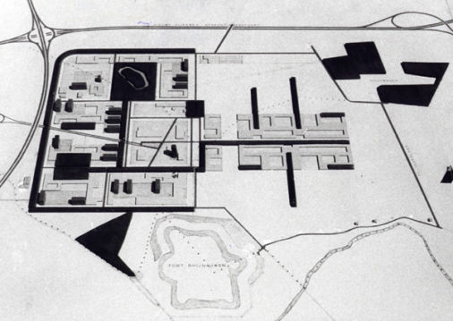
Masterplan 1960 J.A.G. van der Steur
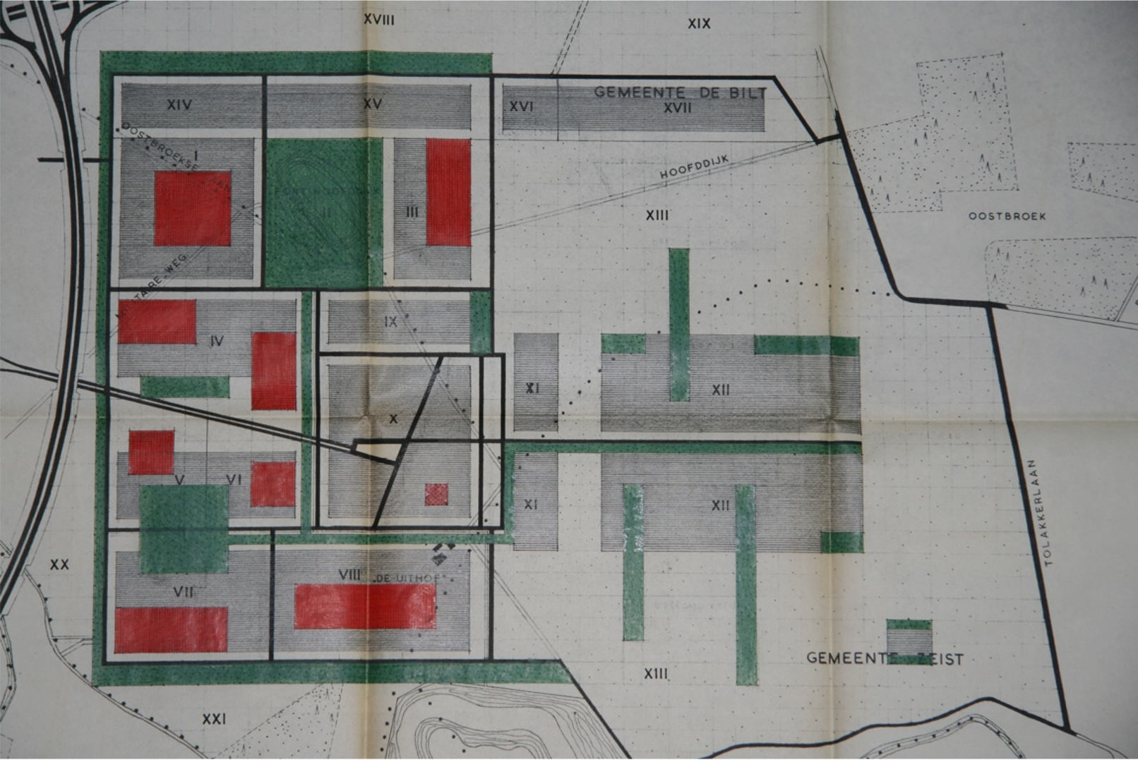
Masterplan 1960 J.A.G. van der Steur
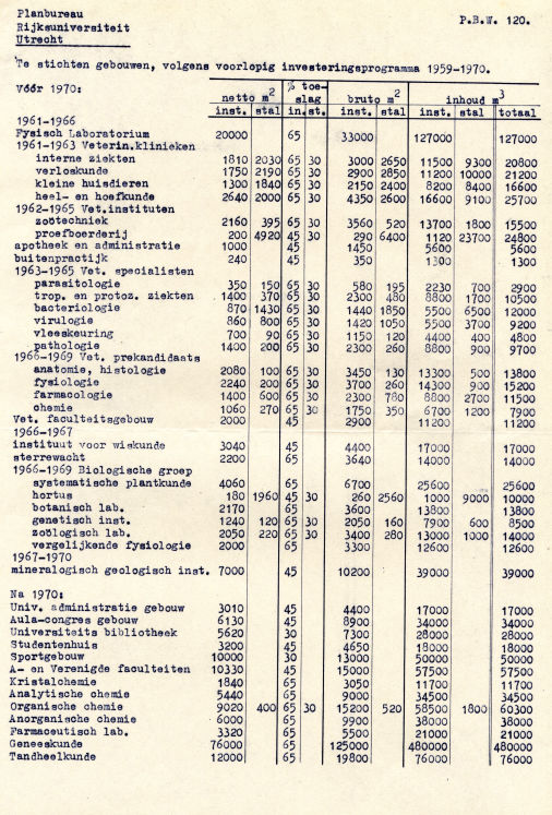
Masterplan 1967, J.A.G. van der Steur.
Below, picture on the left, the masterplan of Van der Steur as it was originally laid out in 1961. The dotted lines depict the city boundaries: Utrecht to the west, De Bilt to the north and Zeist to the east. The motorways are projected where they were realised in later years. The striking orthogonal grid structure is the dominant design principle, the mediaeval Hoofddijk remains only vaguely visible. A special characteristic of this plan is the diagonal path (represented by a double line) from what was to become the centre of 'De Uithof' towards the city centre (the tower of the Dom Cathedral). The line was meant to be free of visible obstacles in order to symbolise the close relation between city and university. The centre of 'De Uithof' did not emerge at this location, but the 'Oxfordpad', now one of the principle bicycle tracks, has been laid out in accordance with the views of Van der Steur.
The dark areas on the map represent forest patches. Just below the one with the fortification 'Werk aan de Hoofddijk' a building volume can be seen to be placed across a dotted line. Here the 'Ruppertbuilding' was constructed across two city territories and the relevant building permits were issued by De Bilt!
The third picture below shows the masterplan of Van der Steur as far as he could take it before his sudden death in 1966. In retrospective, it is interesting to see that this version of the plan included a medical area in the south west corner of 'De Uithof'. The academic hospital was also foreseen to be built here. This position was going to be controversial between the university ad the city of Utrecht in the late 70s.
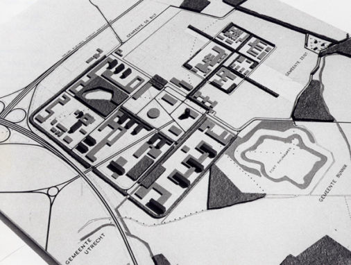
The fourth picture represents the scheme that was drawn by the university 'planbureau' in 1958 illustrating along which lines the university was supposed to develop in the decades to come.
https://mobirise.com best website creator